

We’ve all felt that specific brand of disappointment. It’s 11 PM, you’re miles from the nearest city glow, and you hold your phone up to one of the most spectacular skies you’ve ever seen. You tap the shutter, only to get back a black rectangle. Maybe a few grainy white dots, if you’re lucky.
Overhead, the sky is putting on a masterclass. The arm of the Milky Way—the actual physical structure of our galaxy—is stretched across the darkness like a river made of three hundred billion suns. Your eyes can see it. Your brain knows it’s there. Yet the same phone that photographs your lunch in crisp, vibrant detail has given you absolutely nothing.
It used to be that fixing this required a DSLR, a proper tripod, a remote shutter, a dark-sky location you’d scouted months in advance, and somewhere between four and six hours of your Saturday night. It was a hobby with a steep entry fee.
It isn’t anymore. Not quite.
Today’s smartphones can capture surprisingly detailed photos of the Milky Way with the right settings, a stable surface, and genuinely dark skies. You don’t need an expensive camera to get started; you just need realistic expectations and a little preparation.
Here is the short version of how to photograph the Milky Way with a phone: Get to a Bortle 4 or darker sky on a moonless night, brace the phone on something that cannot move, and give it the longest exposure it allows. On an iPhone, that means Night mode set to Max. On a Google Pixel, it means Night Sight’s Astrophotography mode. On most other Android phones, it means Pro mode at 15 to 25 seconds and ISO 1600 to 3200.
The rest of this guide walks through each step, so you can stop guessing and start shooting.
What You’ll Need (It’s a Short List)
Before you head out, make sure you have:
- A phone with Night mode, Night Sight, or a Manual/Pro mode
- Dark sky (Bortle Class 4 or darker)
- Stable support or tripod
- Clear, moonless night
- A fully charged battery (and a power bank for a long night)
- Patience
That’s the whole kit. Everything after this point is pure technique, and almost all of it is completely free.
Why Your Phone Can See More of the Milky Way Than You Can
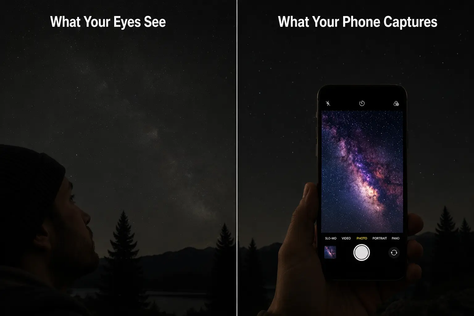
Here’s a secret that doesn’t get talked about enough: if you know what you’re doing, your phone will actually show you a sky your naked eye cannot see.
Not a fake, processed sky. The real one, and far more of it.
Human eyes evolved for motion and survival, not deep-sky observation. After dark, the color-sensing cones in your retina largely stop contributing, and vision falls to the rod cells, which are highly sensitive but completely colorblind. That is why the Milky Way in person looks like a pale, silvery smear. Dramatic, yes. Colorful, no.
A camera sensor has no such biological limit. Hold a smartphone shutter open for fifteen seconds, and it behaves like a bucket left out in the rain, collecting photons the entire time: the faint reddish glow of hydrogen clouds, the cold blues of dust lanes, and the subtle purples of ionized gas.
Your phone’s computational photography software then stacks and processes that light. What comes back on your screen sits somewhere between a casual snapshot and a scientific image.
The colors are real. The detail is real. You aren’t adding anything that isn’t there; you’re just collecting more of it than a human retina can manage in a single glance.
One honest caveat: none of this works without a genuinely dark sky. Not “suburban dark,” and not “camping dark near a major highway.” You need the kind of dark where your eyes take 20 minutes to fully adjust and you can hold up a hand and barely make it out. On the Bortle dark-sky scale, that means Class 4 or darker.
If you’re unsure whether your location qualifies, the free map at lightpollutionmap.info will tell you before you make the drive. Heading somewhere remote? Our guide to Predator Awareness While Stargazing covers how to stay safe at isolated dark-sky sites.
When Is Milky Way Season? Best Months and Moon Phase
Milky Way season is the stretch of the year when the galaxy’s bright core, the region toward the galactic center in the direction of Sagittarius and Scorpius, is above the horizon during dark hours. From the Northern Hemisphere, that is roughly April through October. June through August is the prime window, when the core rises high enough to actually photograph: NASA’s skywatching guide notes that the central bulge is visible all night in June and continues through August.
Outside those months, the galactic center is either below the horizon after dark or too close to the Sun to see. On winter nights, we face away from it, toward the galaxy’s sparse outer edge. You can still photograph stars and star trails in winter, and winter skies have their own stark beauty, but the classic, sweeping Milky Way arch? That’s a warm-weather phenomenon.
The Moon is the other major variable, so always check a sky app before committing to a night out. A full moon in July is nearly as destructive as moderate light pollution; it drowns out the faint stuff entirely. The four or five days before and after a new moon give you the darkest, most forgiving conditions.
Plan in order. Find your dark sky location first. Then check the moon phase. Then check the weather. Even thin clouds, haze, humidity, or wildfire smoke can cut contrast badly, making the Milky Way much harder to photograph than a clear forecast alone suggests.
How to Keep Your Phone Still Without a Tripod
Sharpness is everything in astrophotography.
You are photographing objects so faint that the camera needs ten to thirty seconds just to collect enough light to show them. During those seconds, any movement at all—hand tremor, wind, someone walking past, or even the ground settling—will smear pinpoint stars into short, blurry streaks.
A proper tripod costs $40 to $200. It’s absolutely worth owning if you do this more than twice. But if you’re out on a trail and the sky has just opened up, you can improvise brilliantly with what’s already in your pack.
- The boot cradle. This is the one that actually works in the field. Take off a hiking boot (it’s insulated, stiff, and holds its shape), set it on flat ground, and wedge the phone lengthwise into the ankle collar with the lens pointing toward the sky. The boot spreads the weight and soaks up vibration better than most improvised rigs. I’ve saved more than one shoot by sacrificing a boot to the cause.
- The water bottle lean. A full 1L bottle on flat ground, with the phone propped against it, stabilized at the base with a small stick or pebble. It’s less stable than the boot, but highly usable in a pinch.
- The flat-face rock angle. Place the phone face-down on a smooth rock with the lens hanging over the edge, pointing directly up at the zenith. This is great for straight-up shots of whatever is overhead, though less ideal if you want to frame something specific on the horizon.
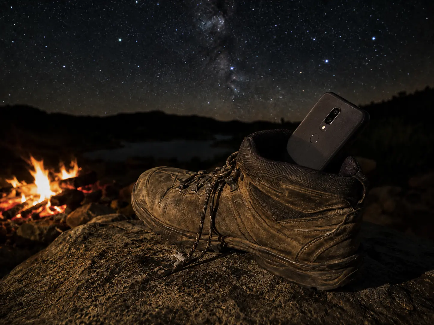
None of these are as reliably perfect as a dedicated tripod. Worth saying plainly.
Whichever method you use, always set a timer before the shutter fires. Pressing the shutter button with a finger shakes the phone just enough to blur a long exposure, and a short delay lets the device settle. Google, for one, recommends a 3-second self-timer for Pixel astrophotography; a two-second or 10-second delay works perfectly on any phone.
Best Camera Settings to Photograph the Milky Way With a Phone
iPhone: Night Mode Set to Max
The built-in iPhone Camera app has no manual ISO or shutter-speed controls. What it does have is Night mode, available on iPhone 11 and later, which turns on automatically in low light and shows a yellow moon icon at the top of the display. For Milky Way photography, you want to push it to its maximum exposure time.
Open the camera and let Night mode activate. Apple’s current instructions (support article published February 2026, checked October 22, 2026) are to tap the arrow above the viewfinder, tap the Night mode button, then drag the slider above the shutter button to Max. Depending on how dark your environment is, this will give you anywhere from a 10-second to 30-second exposure.
Next, lock your focus. Touch and hold a bright star in the frame until “AE/AF Lock” appears. This stops the phone from frustratingly hunting for focus in the dark.
If you want more granular control over ISO and shutter speed independently, third-party apps like Halide or NightCap Camera hand that over to you. They’re worth the few dollars if astrophotography becomes a regular weekend ritual.
Android: Pro Mode, Pixel Astrophotography and Samsung Expert RAW
Android varies more by manufacturer. Nearly every flagship from the last four years has a Pro or Manual mode in the camera app; swipe through the shooting modes to find it.
Two brands add a dedicated night-sky option. On a Google Pixel, open Night Sight and set the phone on a tripod or other steady support without holding it; Google says the shutter switches to Astrophotography mode on its own once the phone is still. On Samsung Galaxy phones that support it, the Expert RAW app adds an astrophotography mode with a Sky Guide overlay that maps constellations right as you frame your shot.
In Pro mode, start here:
- ISO: 1600 or 3200. A higher ISO makes the sensor more responsive to faint light, but it also amplifies electronic noise (that grainy texture in dark images). ISO 3200 records more of the sky; 1600 gives a cleaner frame. On a very dark night, 1600 is often plenty.
- Shutter speed: 15 to 25 seconds. Longer isn’t always better: leave the shutter open too long and Earth’s rotation turns stars into short trails instead of points. At a standard wide-angle field of view, 25 seconds is roughly the limit before stars start to elongate noticeably. A useful rule of thumb is the 500 Rule: divide 500 by your full-frame equivalent focal length to estimate the longest exposure before stars begin to trail. For a smartphone with a typical 26 mm equivalent lens, that’s around 19 seconds. Computational processing and sensor differences mean the real limit varies from phone to phone, so treat that number as a starting point.
- Focus: infinity. Look for the mountain icon, or a slider that goes from “macro” to “∞.” In near-total darkness, autofocus has nothing to lock onto and will hunt indefinitely, producing a blurry frame. Set it manually and leave it.
Treat all of these settings as a first pass, then fine-tune them for your phone model and the sky you’re actually under.
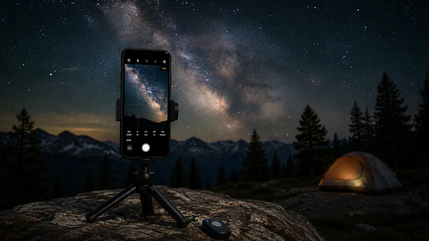
If your phone supports RAW (DNG) capture, use it. RAW files keep more image data than JPEGs, which gives you more room to reduce noise and recover faint detail when editing. On iPhone 12 Pro and later Pro models, that means turning on Apple ProRAW in Settings > Camera > Formats. Apple says ProRAW also works with Night mode, though Night mode RAW files are saved at 12 MP.
Where Is the Galactic Core? Find It Before You Shoot
Here’s where people go wrong: they point the phone generally “up” and hope.
The Milky Way has a center, the galactic core, and it’s orders of magnitude brighter and more detailed than the rest of the band. It sits in the direction of the constellation Sagittarius, low in the southern sky for Northern Hemisphere observers during summer months.It looks almost like a faint cloud when you finally find it: a dense, luminous bulge in the band of the galaxy. NASA’s Night Sky Network suggests using the Teapot, a bright group of stars in Sagittarius, to pinpoint it.
Download Stellarium (free) or Star Walk before you lose cell service, then use it to find Sagittarius. Switch the app to its night mode, which turns the screen red so it doesn’t wreck your dark-adapted night vision, and confirm the core is above the horizon.
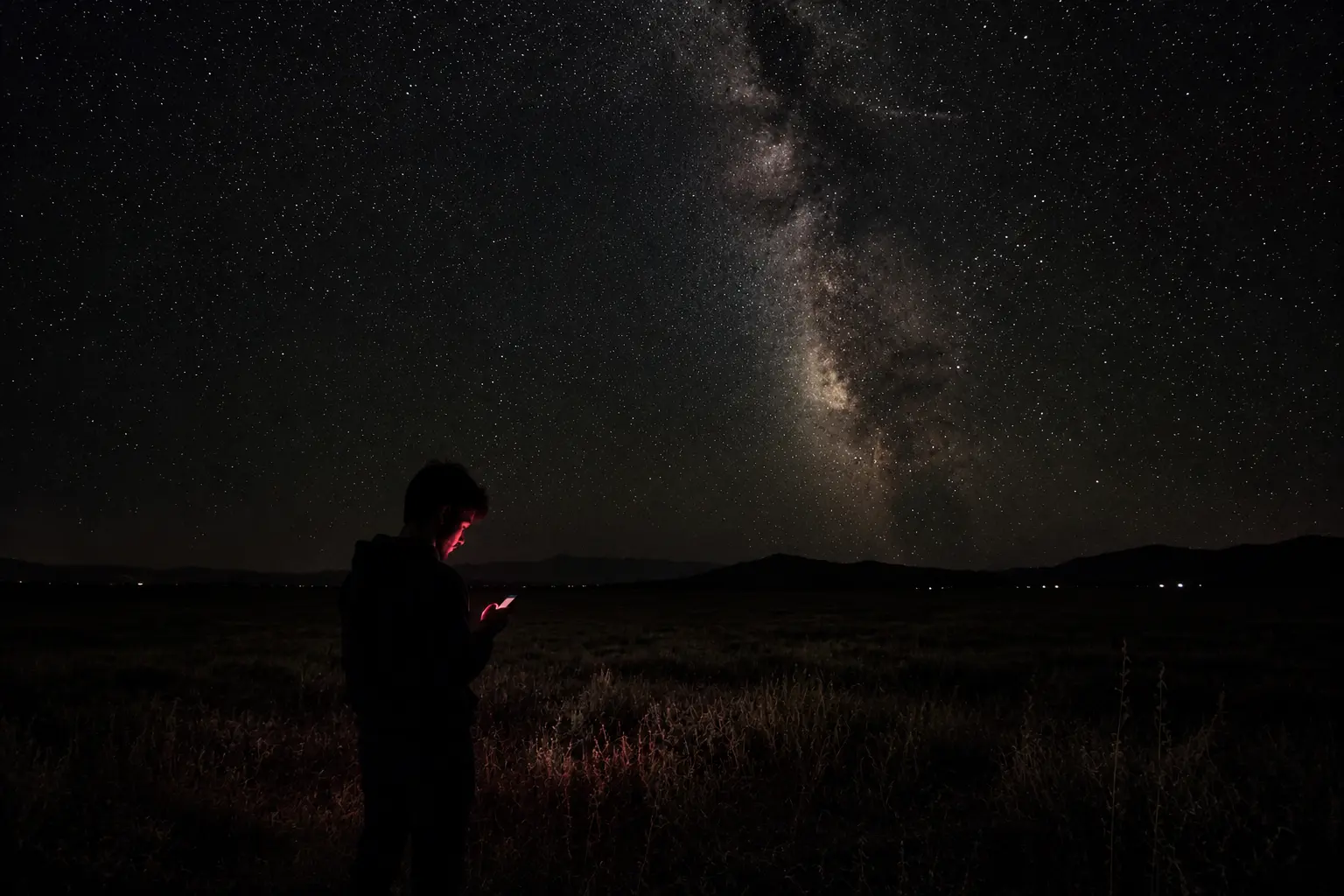
Early in the night, say 10 pm in June, the core may still sit low. Low is fine. It actually makes for dramatic foreground compositions. What you want to avoid is aiming at the part of the sky away from the core, which looks fairly featureless by comparison.
Editing Milky Way Photos in Snapseed or Lightroom Mobile
Phone astrophotography images almost always benefit from a little digital darkroom time. Not heavy, destructive editing—just bringing out what the sensor already recorded.
In either app, raise highlights a little, lower shadows even more gently, add clarity to bring out texture in the nebulae, and apply noise reduction if the frame looks grainy. That’s it. You aren’t adding anything the camera didn’t capture; you’re just making the data easier for the human eye to see.
What you should not do is crank saturation until the sky turns magenta. The colors in a Milky Way photograph are naturally subtle. Oversaturating them makes the image look cheap and processed rather than astronomical.
Always keep the original image untouched. Edit a duplicate so you can compare the result with the unedited frame, or start over if you push the sliders too far.
Quick Troubleshooting: Blurry, Noisy or Missing Stars
| Problem | Quick Fix |
|---|---|
| Blurry photo | Stabilize the phone, use a timer, lock focus. |
| Too much noise | Lower ISO or photograph under darker skies. |
| Can’t see Milky Way | Check the moon phase, light pollution, and weather. |
| Star trails | Reduce exposure time. |
Learning to photograph the Milky Way with a phone takes a few nights of practice, and every session teaches you something new about both your equipment and the night sky.
One Last Thing
The galaxy in those photos is not somewhere out there, distant and separate.
The Milky Way is our galaxy. The sun is one of its stars. Earth is one of its planets. When you photograph that band of light arching across the sky, you are, in a very literal sense, photographing your own neighborhood from the inside, looking sideways along the disk you’re embedded in.
That takes a moment to actually land.
Go find somewhere dark enough for it to land.
Frequently Asked Questions
Yes, but results depend on the phone’s camera capabilities. Most recent flagships can, using Night mode (iPhone 11 and later), Night Sight’s Astrophotography mode (Pixel) or a Manual/Pro mode, as long as the sky is properly dark. Older or entry-level phones may still photograph bright stars, but they’ll struggle to record the galaxy’s faint details.
A tripod gives the sharpest and most consistent results, but it isn’t essential. Any stable surface, such as a hiking boot, rock, backpack, or water bottle, can keep your phone steady during long exposures. Just remember to use a 2- or 10-second timer to prevent vibrations when pressing the shutter.
Start at ISO 1600 to 3200 when shooting in Manual or Pro mode. Lower ISO values produce cleaner images with less digital noise, while higher ISO settings capture more light but can make photos appear grainy. Experiment with both depending on your phone and the darkness of the sky.
Because the Milky Way is surprisingly faint, light pollution, moonlight, haze, thin clouds or even one nearby porch light can hide it. For the best results, choose a moonless night, let your eyes adjust to the dark for at least 20 minutes, and photograph from a location with a Bortle Class 4 sky or darker.
Yes, but not the bright galactic core that most people associate with Milky Way photography. On Northern Hemisphere winter nights, the core is below the horizon during the dark hours, though you can still capture fainter sections of the Milky Way along with winter constellations and star fields.
Wait until twilight has fully faded. Google’s Pixel guidance suggests shooting stars at least 45 to 90 minutes after sunset. In June the core is up all night, so any moonless hour after full darkness works; at other times of year, check a planetarium app for when the core clears the horizon at your location.