

Wind is air moving from high pressure to low pressure. That’s the entire mechanism. Everything else, from the gust that flattens your tent at 2 a.m to the steady breeze that keeps mosquitoes off a lakeshore or the gale that turns a mountain pass into a wind tunnel, is that same principle playing out at different scales.
Here’s where it gets interesting: air doesn’t move because it “wants” balance in some poetic sense. It moves because physics leaves it no other option.
What Causes Wind to Blow?
The sun is the engine behind every breeze you’ll ever feel.
Not directly, though. The sun doesn’t blow air around like a fan. It heats the Earth, and it heats it unevenly, and that uneven heating drives differences in temperature and pressure throughout the atmosphere.
Uneven heating drives the process:
- The equator receives sunlight almost straight on, all year round. The poles get it at a steep angle, spread thin across a much larger surface area.
- Land heats up (and cools down) far faster than water. A parking lot in July and the lake next to it prove that well enough.
- Dark surfaces, asphalt, bare soil, absorb more heat than pale ones like sand, snow, or open water.
Warm air is lighter than cool air, so it rises. Cool air is heavier, so it sinks and rushes in to fill the space left behind. That rising and sinking, repeated endlessly across a planet that’s hot at the equator and cold at the poles, sets the entire atmosphere in motion.
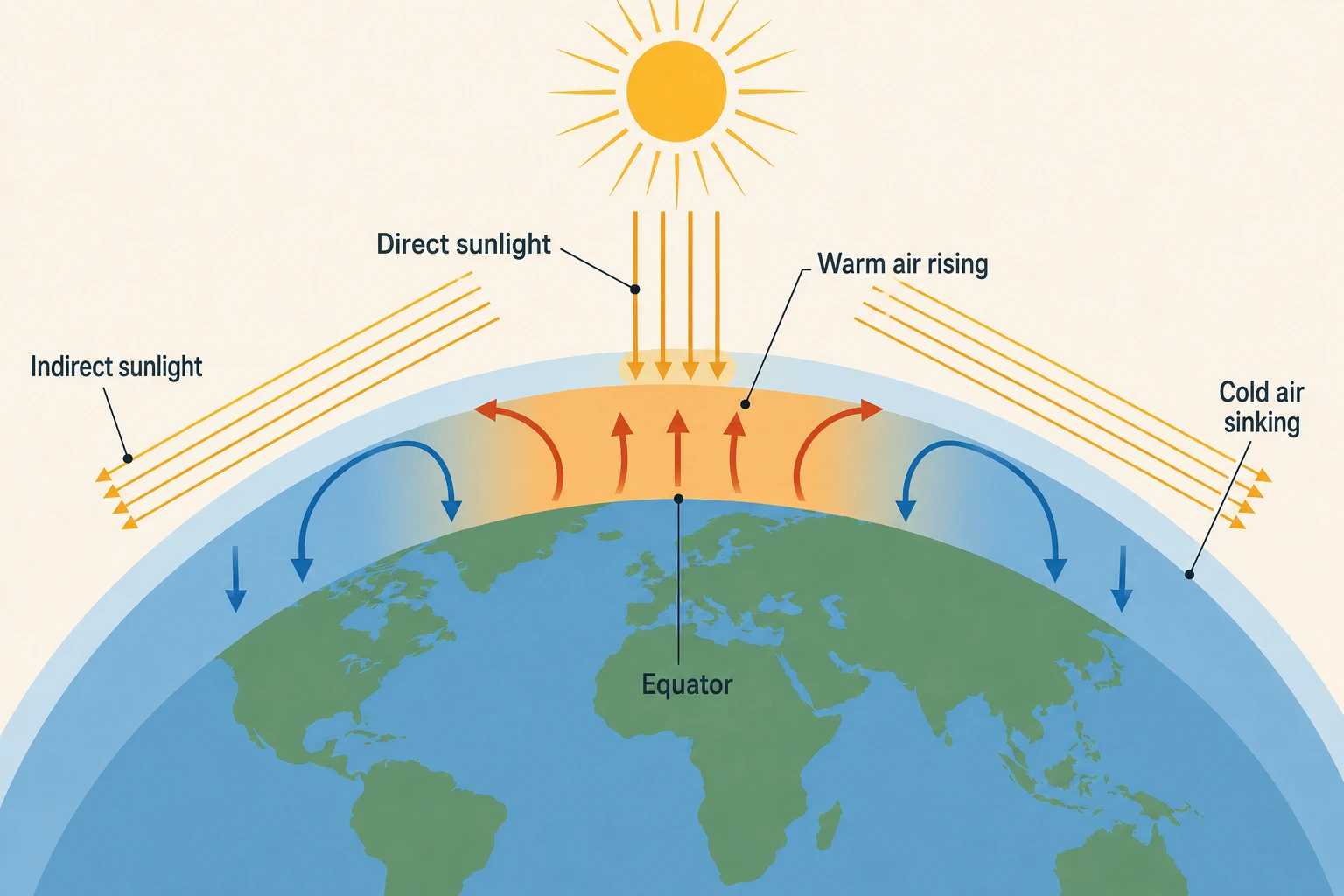
Wind, at its most basic, is a convection engine trying to fix a temperature imbalance that never quite gets solved.
The same principle plays out on a much smaller scale near any coastline or large lake. During the day, land heats faster than water, so air rises over land and pulls cooler air in off the water, creating a sea breeze. At night the pattern flips: land cools faster, and the breeze reverses, blowing offshore instead. Anyone who’s camped near open water has probably felt this shift without knowing there was a name for it.
What force causes the wind to blow?
Temperature differences help create pressure differences. Pressure differences are what directly accelerate air and produce wind.
Here’s the mechanism: warm, rising air leaves fewer molecules behind at the surface. That’s a low-pressure system: light, thin, wanting more. Cool, sinking air piles molecules up at the surface. That’s a high-pressure system: dense, heavy, and needing somewhere to go.
Think of a balloon. Squeeze one end and the air doesn’t just sit there; it rushes toward whichever end has more room. High pressure behaves the same way. It’s a crowded room looking for an exit, and low pressure is the open door.
Air always moves from high pressure toward low pressure, trying to equalize. It never fully succeeds, because the sun keeps heating things unevenly, so the imbalance regenerates about as fast as the air can correct it.
This is also why weather maps mark systems with the letters H and L. Each identifies a region of relatively high or low atmospheric pressure, while isobars connect points of equal pressure. The spacing of those isobars can also give you a quick visual sense of how strong the pressure gradient is. Reading one of these maps is really just reading where air is about to rush from, and where it’s headed.
💡 Bottom Line
Pressure differences are the immediate driver of wind. The greater the pressure difference over a given distance, the stronger the force acting on the air.
What causes wind to blow in a particular direction?
If Earth didn’t spin, wind would travel in a straight line, high pressure to low pressure, point A to point B, done.
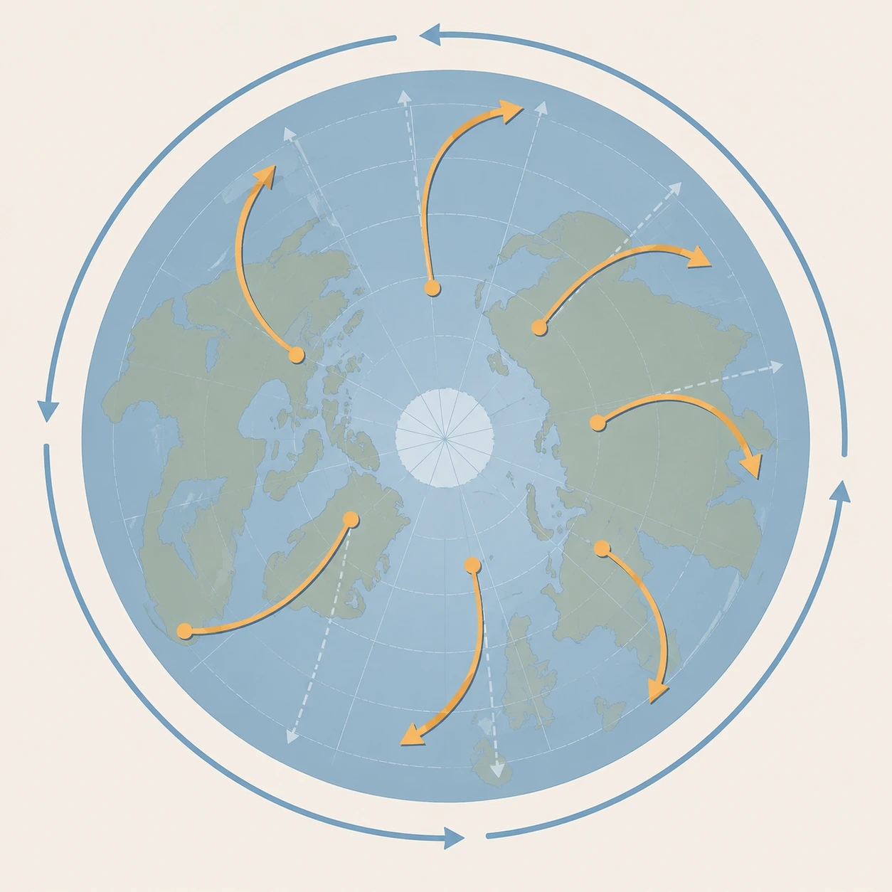
But Earth does spin, and that changes things considerably. This is the Coriolis effect, and it’s the reason wind curves instead of traveling straight.
As air moves across the globe, the ground underneath it is also moving, just at different speeds depending on latitude. (The equator spins faster than the poles, since it covers more distance in the same 24 hours.) The air appears to bend off its original path because the surface beneath it is rotating out from under it.
The result: wind curves to the right in the Northern Hemisphere and to the left in the Southern Hemisphere. It’s the same reason hurricanes spin the way they do, and why weather systems on a map never travel in a clean arrow from A to B.
What causes the wind to blow so hard?
This comes down to how quickly pressure changes over a given distance, something meteorologists call the pressure gradient.
Picture a topographic map, but instead of elevation lines, it’s pressure lines, called isobars. When those lines sit far apart, pressure changes gradually and the wind stays mild. When the lines are crammed close together, pressure changes fast over a short distance, and the air accelerates hard to compensate.
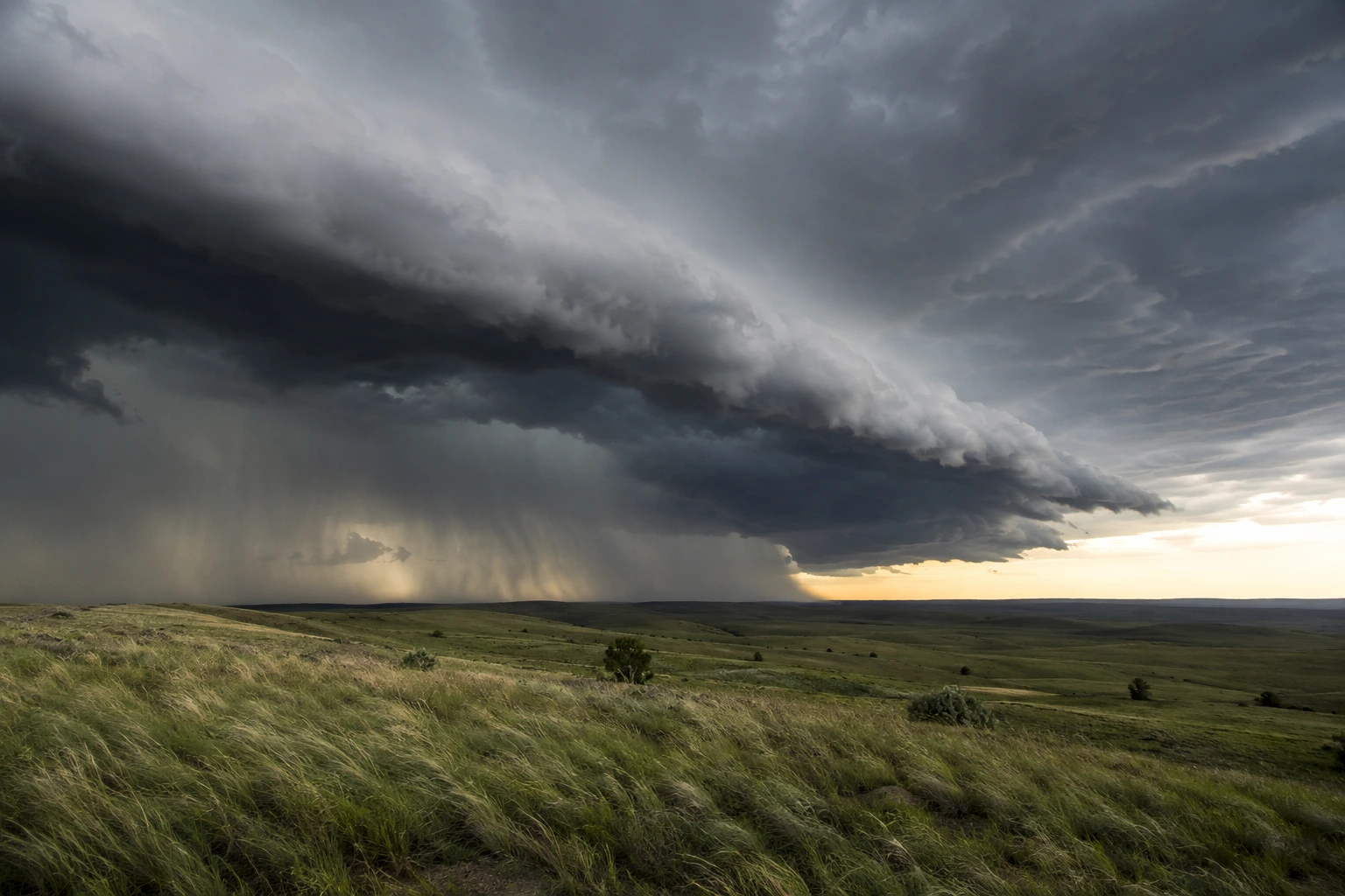
Storms are the extreme version of this. A hurricane or a strong low-pressure system can create a steep pressure gradient, accelerating air and producing powerful winds.
That’s why a calm day on a trail can feel almost motionless, while a storm front rolling in turns the same quiet ridge into something that knocks you sideways within the hour.
Not all of it is large-scale, either. Close to the ground, friction from trees, buildings, and uneven terrain breaks smooth airflow into chaotic little swirls. That’s part of why wind at ground level often feels gustier and more erratic than the wind reported for the area, which tends to be measured well above the clutter.
Why Understanding Wind Matters Outdoors
Wind becomes much more interesting once you’re outside because the same forces you’ve just learned about can change how a campsite, trail, or night sky feels.
For campers, wind can be more important than temperature when choosing where to pitch a tent. An exposed ridgeline can feel dramatically different from a sheltered site. Wind chill can make a 50°F night feel far colder than the thermometer suggests, and the design of the tent matters more in wind than in rain. Low-profile dome-style tents generally handle strong winds better than taller designs.
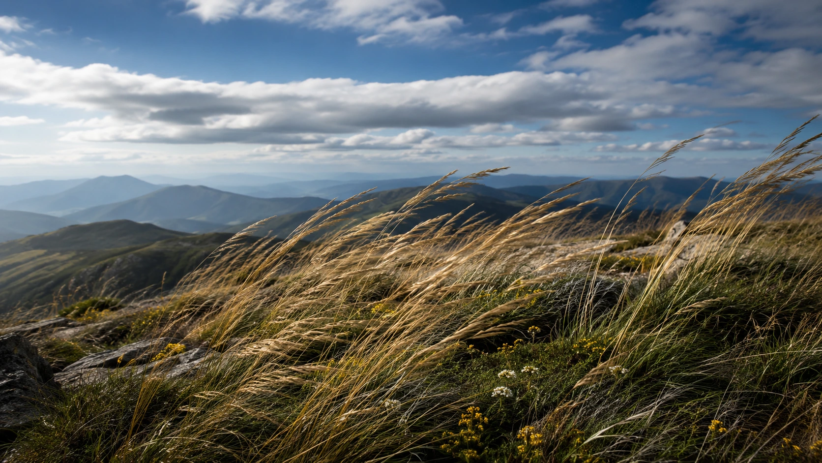
In the mountains, wind can also change direction with the time of day. Slopes heat during daylight and cool after sunset, creating local upslope and downslope flows. These anabatic and katabatic winds can turn a mild afternoon breeze into a cold downslope flow after dark.
And for stargazers, wind is only part of the story. What matters most for telescope views is atmospheric turbulence, or “seeing.” When different layers of air are moving and mixing, they can distort incoming starlight and make distant objects appear to shimmer or blur.
Understanding wind won’t let you predict every gust, but it gives you a better sense of why the same landscape can feel completely different from one hour to the next.
💡 Bottom Line
Understanding wind helps you make better decisions about camping, stargazing, hiking, and choosing an exposed or sheltered location.
Frequently Asked Questions
Wind is caused by air moving from areas of high pressure to areas of low pressure. Those pressure differences exist because the sun heats the Earth unevenly, warming the equator more than the poles and land faster than water.
Both act as physical obstacles that redirect and often accelerate airflow. Mountain passes can funnel wind into a narrow gap, speeding it up considerably (a venturi effect), while dense tree cover slows wind down by adding friction and blocking its path.
A breeze is a steady, sustained flow of air. A gust is a brief, sharp spike in wind speed, usually caused by turbulence or uneven surface heating, that rises and fades within seconds.